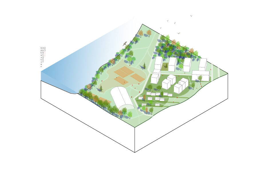
Rives du Bohrie

Long Live and Respect Nature: An Eco-District in Ostwald
In the early 2000s, the Eurometropolis of Strasbourg and the City of Ostwald carried out studies on Rives du Bohrie, an area west of the town of Ostwald near Strasbourg, which extends over 50 hectares left vacant by intensive agriculture. The area is bordered north by the Ostwaldergraben Stream, west by the Bohrie Lake and the Strasbourg-Basel railway line, south by the Allée du Bohrie, which is traversed by the tram line, and east by the edges of the Wihrel and Belle-Hélène districts as well as the Point d’Eau Cultural Center.
This study led to the development of a new district consisting of 1,400 homes underpinned by six key objectives:
Building a Resilient Landscape that Embraces Water
Structured around water, with the Ostwaldergraben Stream, Bohrie Lake, and the permanent and seasonal wetlands, the Rives du Bohrie district makes the most of its natural spaces, both for the comfort and visual quality of this new residential district, but also to respect the water cycles, with areas designed to evolve. The shallow ditches, which are normally dry, fill up during periods of rain, transforming both the neighborhood and the public spaces.
Living in Nature
The Rives du Bohrie program prioritizes nature: 60% of the site’s 50 hectares were left out of the urbanization plan. The program therefore included, as a way to increase the wetland footprint, building connections between the existing natural spaces to promote biodiversity, opening up spaces occupied by a hydrophilic meadow for storing water in the event of flooding, a renaturing area, family gardens, a market gardening space, and walking areas around the lake.
Delivering Quality Private and Public Spaces
The aspect of public spaces was also considered within urbanized areas, i.e., accounting for 30% of the 50 hectares of the Rives du Bohrie site: areas for play and walking. To improve quality of life, soft transport was promoted and urban and architectural forms were designed to offer maximum comfort and save resources, particularly energy resources.
A lively neighborhood open to the city
The neighborhood was designed as a local area: shops, services, transportation and public facilities are located on the ground floor of the buildings on Allée du Bohrie. Shared gardens, sports and relaxation areas, and nature outings have also been set up and offer opportunities to strengthen social ties.
Priority to soft mobility
The impact of cars and other motorized transportation is limited to improve comfort and quality of life. The roads and parking spaces have therefore been designed with this in mind.
Three sectors, three atmospheres
The Rives du Bohrie project consists of three sectors, each with specific issues that have led to different urban forms and ways of living. The “La Ville à Quai” sector is located on the Allée du Bohrie, which is a tram line. It is the densest area of the neighborhood, with the development of collective housing, as well as public facilities and local shops and services. The “L'Ile” sector is more marked by nature, with a focus on individual housing and in particular patios and greenhouses. Finally, the “Quartier du Point d'Eau”, made up of collective housing, provides a transition between the new Bohrie district and the historic Wihrel district. In addition, the Point d'Eau cultural center offers the opportunity to develop leisure activities with the establishment of a multisports hall, a school complex and a festive public square.
Axonometry
Sebastien Hascoët
