Weifang

Weifang, Chine
2016
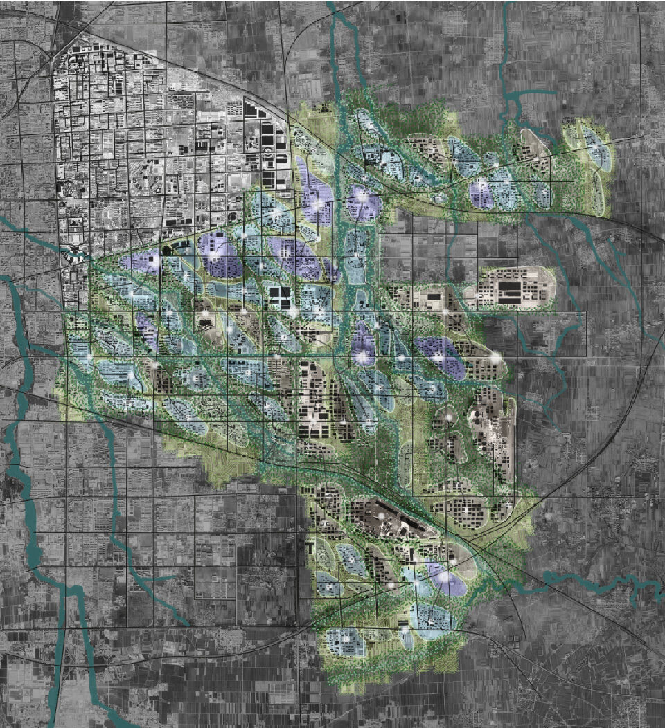
Axonometric Projection Block Plan

The city of Weifang, in China’s Shandong province, was looking to reconsider its urban model based on Chinese principles. As part of the program, DGT and Richez Associés drew up the master plan for the high-tech city extension. Framed around natural infrastructure, programming, and uses, the proposal included providing residents with essential and recreational services. This remodeled city aligns with the specifications of the sustainable city, factoring in the site’s high risk of water stress, groundwater pollution, and heatwaves.

Axonometric Projection Layers of the Environmental Grid
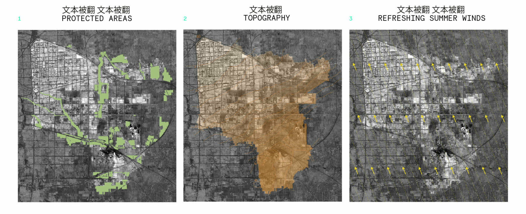
  1. Integrating protected areas and using them in the natural network.
  2. The topography is harnessed to plan the water flow path and manage rainwater naturally with green spaces.
  3. Opening up the urban form to the summer wind to cool the city in hot weather by eliminating humidity in public spaces and buildings.
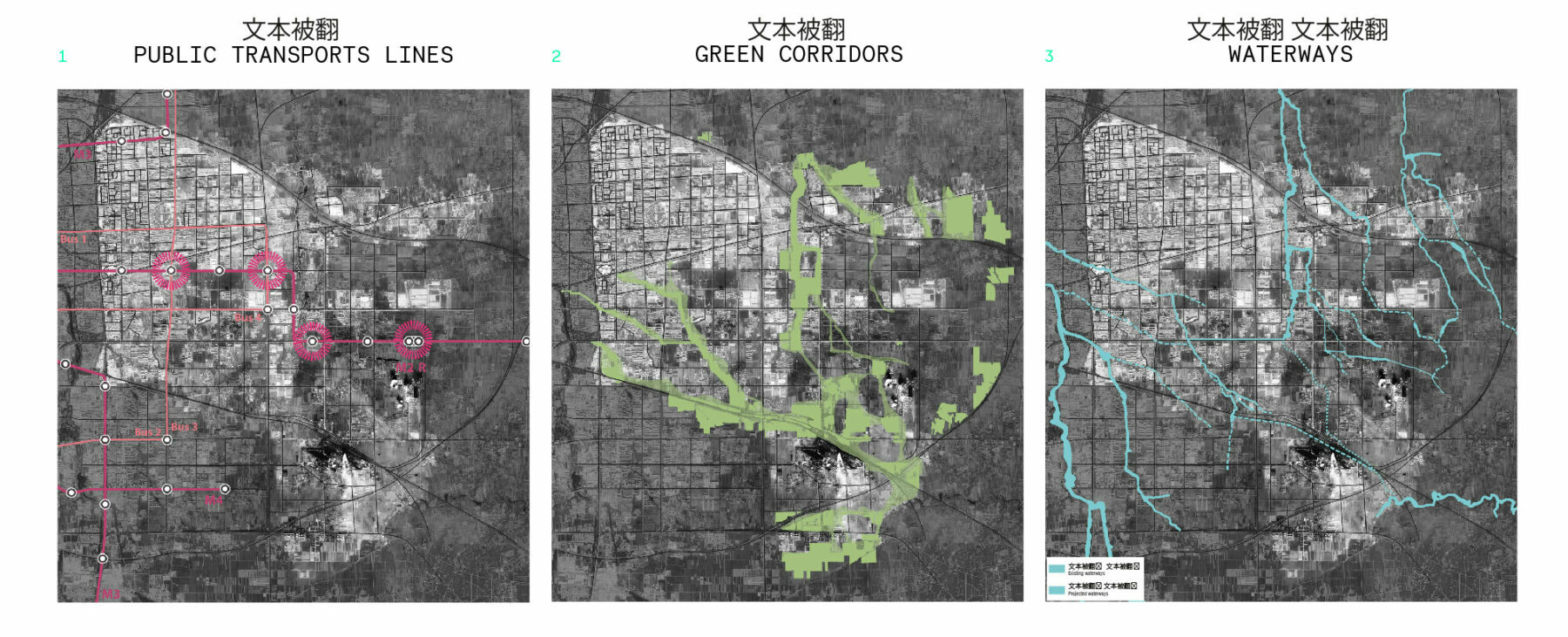
Axonometric Projections Maps 1 2 3
  1. Public transport lines determine the main nodes of intensity.
  2. Expanding watercourses, adding green spaces around protected areas, and linking them all together to allow the flow through of water, vegetation, and wildlife.
  3. Showcasing existing rivers and waterscapes. Identifying historic waterways. Coping with flash floods and keeping Weifang’s water underground. The new watercourses will not always be filled with water, but will be used to retain and channel water during heavy rainfall.

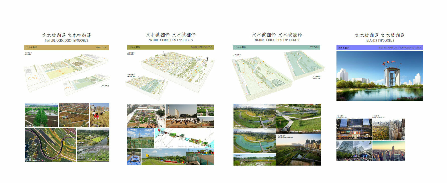
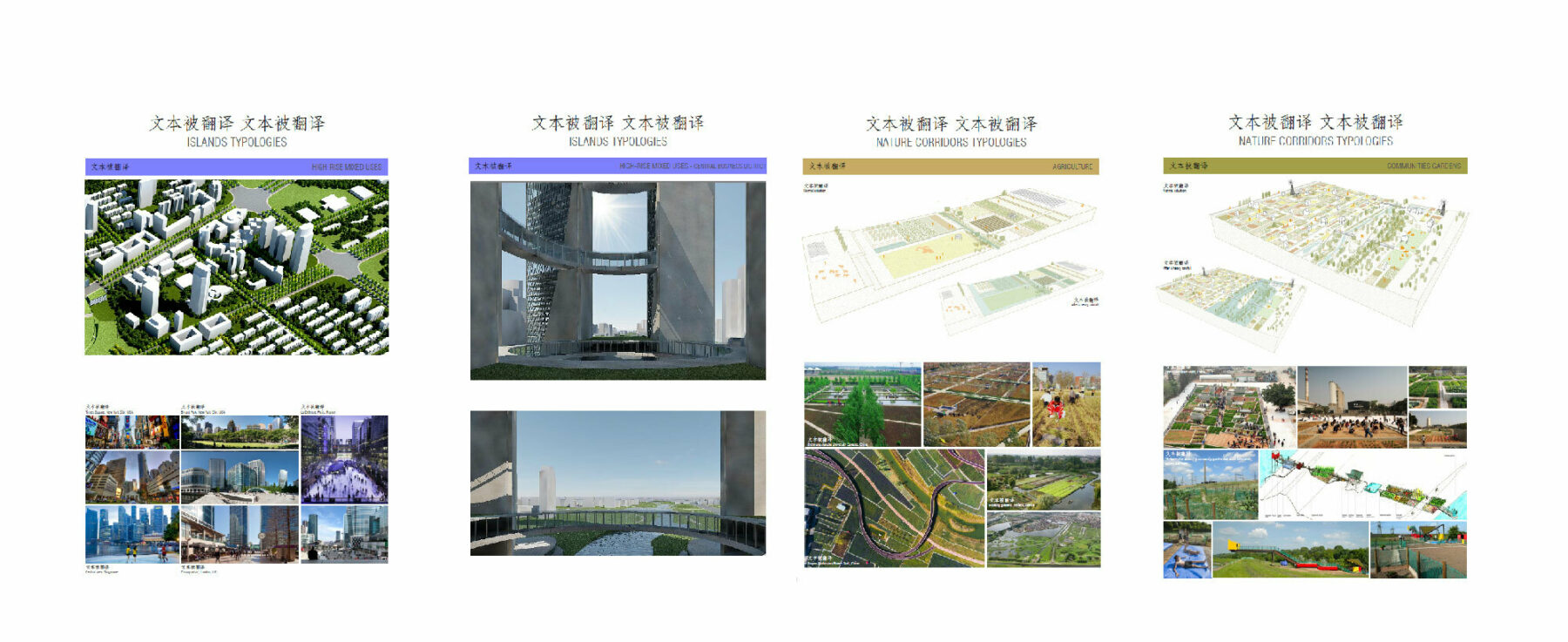
For this program, our studio developed a method for drawing up the guide plan. Hydraulic and ecological continuities, prevailing winds, and topography are layered on top of the existing orthogonal road network to create an organic plan. The “urban islands” thus formed become the “negative” part of a reinforced natural framework, providing ecosystem services, such as the management of heavy rainfall, and supporting a variety of uses and functions (agriculture, sport, wind power generation). The transport network and the position of the islands determine their density and programming to ensure coherent, contextualized development. This natural framework promotes the restoration of impaired ecological cycles, provides ecosystem services such as the management of heavy rainfall, supports a variety of uses and functions (agriculture, sport, wind energy production), and strengthens the region’s resilience to climate change.

Axonometric Projection Island Typologies

A city reshaped by the water matrix

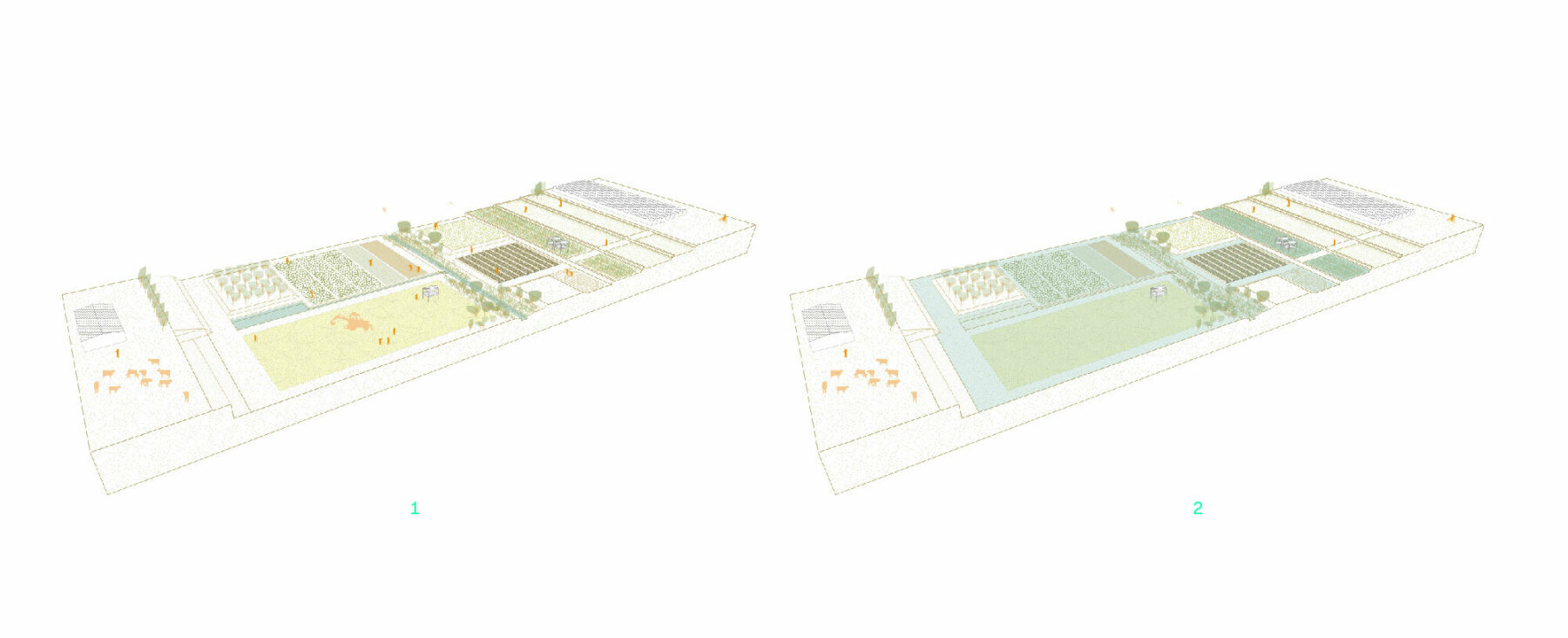
Axonometric Projection for Agriculture

A city reshaped by the water matrix

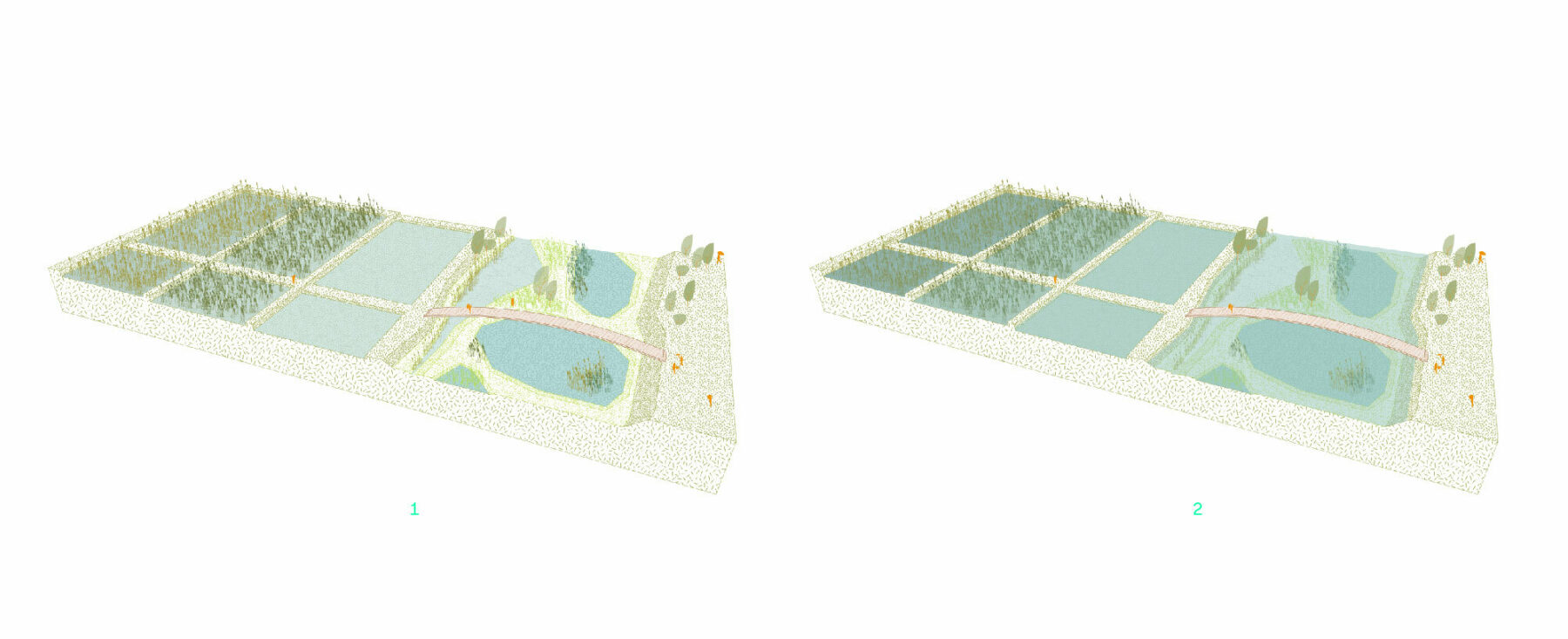
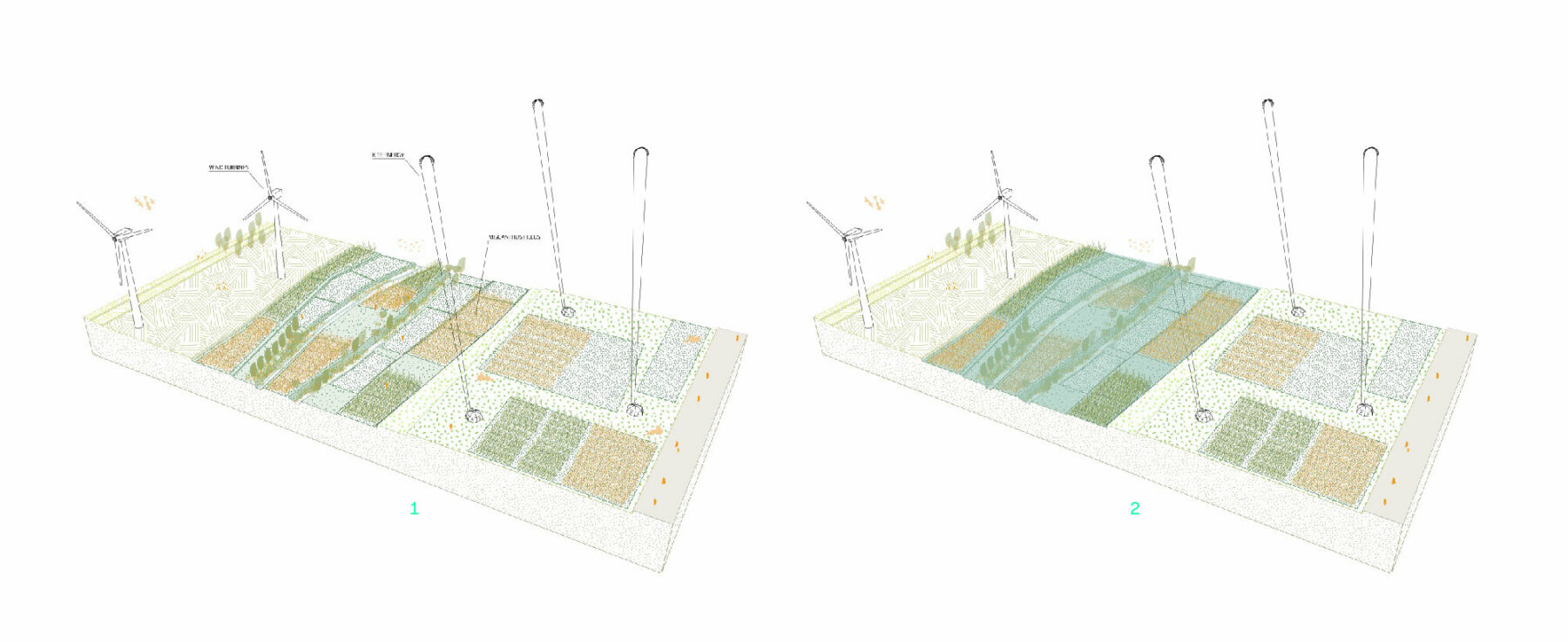
Agriculture

  1. Phreatic low
  2. Phreatic high
Axonometric Projection Pollution Control Park

A city reshaped by the water matrix

Pollution control park

  1. Phreatic low
  2. Phreatic high
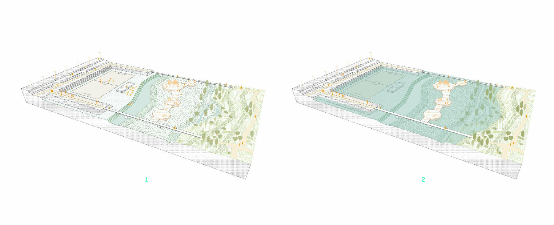
Axonometric Projection Sports Fields

A city reshaped by the water matrix

Sports fields

  1. Phreatic low
  2. Phreatic high
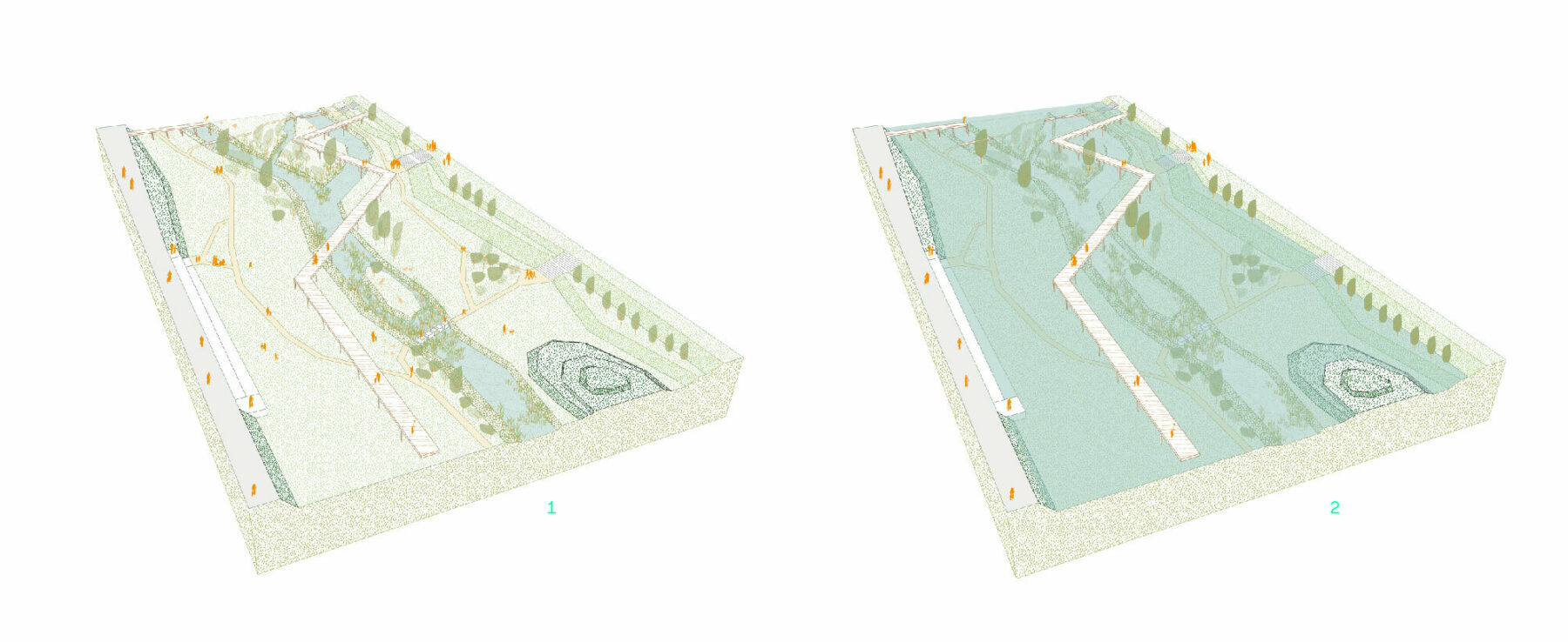
Axonometric Projection City Park

A city reshaped by the water matrix

City park

  1. Phreatic low
  2. Phreatic high
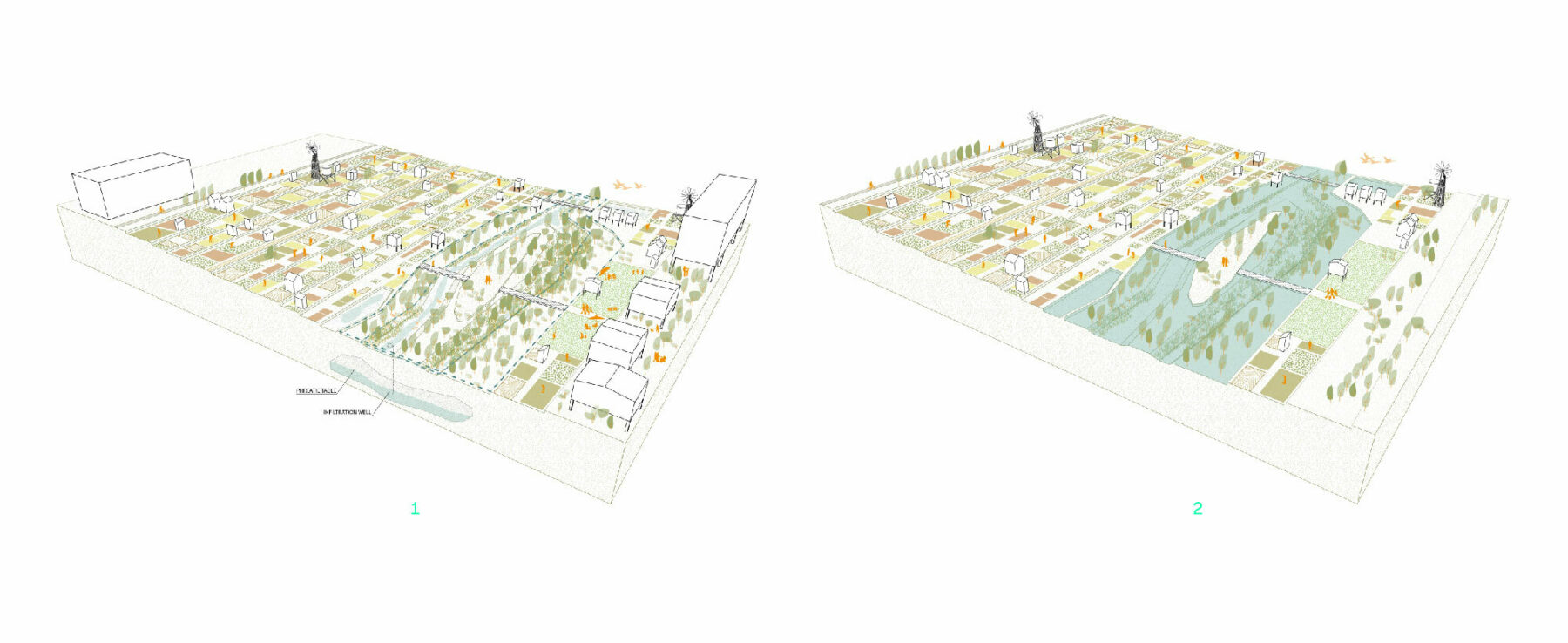
Axonometric Projections Vegetable Gardens

A city reshaped by the water matrix

Vegetable gardens

  1. Phreatic low
  2. Phreatic high
Axonometric Projection Kite Power Renewable Energy Park

A city reshaped by the water matrix

Kite power, renewable energy park

  1. Phreatic low
  2. Phreatic high
Axonometric Projection 2 Island Typologies

A city reshaped by the water matrix

  • Client

    Weifang City

  • Team

    DGT Architectes, Richez Associés, Atelier Franck Boutté

  • Surface

    42.5 mi²

  • Schedule

    2016 (2nd place)

  • AFB Team

    Mohamed Benzerzour
    AFB alumni: Alexandre Bastien, Camille De Gaulmyn, and Florian Dupont